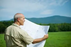
Thinking of buying a block? Want to build your dream home? Or maybe subdividing your backyard? Then you need a land survey.
But there isn’t just one kind of survey. In fact, there are several different types of land surveys. Each one has its own purpose.
So, how do you know which one’s right for you?
That’s exactly what we’re here to break down. But first, a few quick FAQs.
FAQ
- What are the main types of land surveys?
You’ve got boundary, detail & contour, set-out, subdivision, identification, and WAE surveys.
- Why do people get land surveys?
To figure out where their land starts and ends, keep things legal, and get plans approved.
- Do I always need a land survey before building?
Pretty much. If you’re building near a boundary, it’s best to get one to stay out of trouble.
- How can two land surveys be different?
It depends on what you’re trying to do. Different surveys look at different things.
- What’s the difference between a boundary survey and an identification survey?
A boundary survey marks the land on the ground, while an ID survey shows what’s already built on it.
- Who’s allowed to do land surveys in Australia?
Only registered surveyors can legally carry them out here.
What Are Land Surveys?
A land survey is basically a map that shows exactly where your property sits and what’s on it. They help with building, buying, selling, or subdividing. They make sure everything lines up legally and on the ground.
Let’s look at 6 types of land surveys.
1. Boundary Surveys
This one’s probably the most well-known type. A boundary survey shows exactly where your property begins and ends.
Installing a fence, extending your home or buying land? You’ll want to know where your legal lines are before you make a move.
What it does:
- It marks the corners and lines of your land
- Picks up any issues, like a neighbour’s fence sneaking over
- Keeps you on the right side of the law
When to get one:
- Before you build or fence near the edge
- During a sale or purchase
- If there’s a dispute brewing with next door
Imagine this:
You’re halfway through building a fence. Then someone knocks on the door. “Hey mate, that’s actually my land.” Yikes. A boundary survey helps avoid that mess by showing you exactly where things stand.
2. Detail & Contour Surveys
Ever stood on a block of land and thought, “Looks alright… but can we actually build here?”
That’s where a detail & contour survey comes into play. It maps out all the bumps, dips, trees, drains, and other stuff on your land that could affect a build or design.
What it does:
- Maps the land’s slope and surface levels
- Picks up features like trees, fences, and driveways
- Helps architects, engineers, and certifiers plan your project accurately
When it’s needed:
- Before any serious design or DA submission
- For landscaping or drainage design
- On sloped or uneven blocks
Picture this:
You’re sketching up plans for a granny flat on a hilly block. A detail & contour survey would’ve flagged the need for a retaining wall straight away.
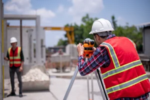
3. Set-Out Surveys
Now we’re getting into the construction side. This is where set-out surveys shine.
They’re all about putting things in the right spot on-site. Think of it like taking your building plans and marking them out on the ground. No room for guesswork here.
What it does:
- Pegs out exact points for walls, slabs, columns, or pools
- Ensures everything is built where it should be
- Keeps certifiers and councils satisfied
When to get one:
- Just before construction starts
- At key stages like slab pour, walls, or pool set-out
Bit of advice:
“Close enough” doesn’t cut it with a set-out. If it’s off by even 50mm, you could end up with compliance issues or rebuild costs.
4. Torrens Title Subdivision
Planning to split your land into two or more lots? You’ll need a Torrens Title Subdivision survey.
This survey divides land into new, individual legal lots. It’s often used for duplexes, triplexes, or small developments.
What it does:
- Divides a parcel into new legal lots
- Prepares a plan for NSW Land Registry Services
- Maps driveways, easements, and access
When to get one:
- Before lodging your DA
- When working with a planner on a dual occupancy
- Prior to selling off part of your block
Heads-up:
Subdivision’s not a DIY job. There are rules, forms, approvals, and a heap of paperwork. You’ll want a surveyor who knows the local process, can work with planners and lawyers, and keeps it all ticking along smoothly.
Our process at East West:
We manage everything from the first survey to plan registration, working closely with your town planner, council, and certifier.
5. Identification Surveys
Now here’s one people often confuse with boundary surveys. But identification surveys are their own thing.
Instead of marking the ground with pegs, it shows what’s already on your land. And how it lines up with your legal boundaries. Think of it as a land “check-up”. Handy when you’re buying, selling, or sorting paperwork.
What it does:
- Shows existing buildings, fences, and improvements
- Checks for encroachments or illegal structures
- Confirms the lot’s dimensions match the title
When to get one:
- When buying or selling property
- When applying for a mortgage or insurance
- Before renovations that affect structure or boundaries
Identification Survey vs Boundary Survey in Australia:
A boundary survey puts physical markers on your land. An Identification survey just shows how things sit in relation to the legal boundaries. No pegs. Just plans. Both are useful. But they’ve got different jobs.
By the book:
In NSW, these surveys have to follow the Surveying and Spatial Information Regulation 2017, and meet the standards of the Land Titles Office. So yeah, you’ll want a licensed pro handling it.
6. Work As Executed (WAE) Surveys
Ever heard of the phrase “paperwork to match the dirtwork”? That’s basically what a work-as-executed survey (WAE or as-built survey) does.
It’s what councils want to see before they give you the green light at the end of a project.
What it does:
- Confirms levels, positions of built structures
- Verifies drainage, services, and everything else matches the plan
- Records any changes made during the build
When to get one:
- After construction’s wrapped up
- Before final inspections or council sign-off
- To meet subdivision or occupancy certificate requirements
Imagine this:
You’ve finished building, everything looks great. Then the certifier says, “Where’s your as-built survey?” Without it, no tick-off, no handover. This survey proves the job’s been done right.
When Should You Get a Land Survey?
A cheat sheet for Aussie property owners!
| Scenario | Survey Type |
| Building a fence or wall | Boundary Survey |
| Designing a house | Detail & Contour Survey |
| Starting construction | Set-Out Survey |
| Splitting your block | Torrens Title Subdivision Survey |
| Buying or selling property | Identification Survey |
| Getting council sign-off | Work As Executed Survey |
If you’re not sure which one you need, just ask a surveyor. Or better yet, give us a call at East West Surveyors.
How East West Surveyors Work
At East West Surveyors, it’s not just about ticking boxes or drawing lines on a map. It’s about helping you make smart, confident decisions with clear and accurate survey data.
We have a full range of surveying services for you, across Greater Sydney. From pre-construction surveys to final reports, we work closely with your team to make sure every structure ends up where it should. No matter the job, we handle it with precision, local know-how, and a practical mindset.
We’re licensed. We’re local. And we make the process feel easy.
Most of all? We make the whole process feel easy!
Practical Tips for Choosing the Right Survey
Know your goal
Building, buying, selling, or subdividing? That’ll guide what survey you need.
Chat with your builder or planner
They’ll usually know what type of survey the job calls for.
Use a licensed surveyor
Only the pros can lodge legal plans and give proper advice.
Ask about their tools
Drones, GPS, and laser scanners help get accurate results faster.
Get your quote early
Costs and timing can vary. Better to lock it in early.
And if you’re ever unsure, just get the survey done. It’s safer than regretting later.
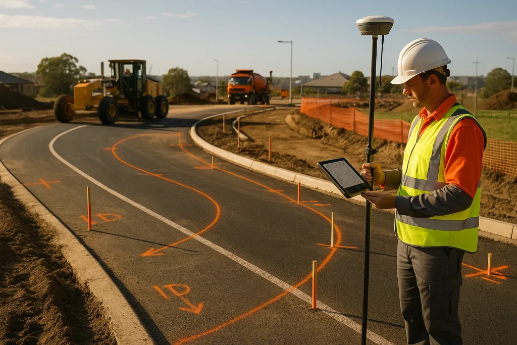
A Note on Land Survey Methods and Techniques
Modern surveying is now different. These days, surveyors are packing some pretty clever tech.
- Total Stations: Measure distance and angles with pinpoint accuracy.
- GNSS (like GPS): Satellite signals to lock in exact positions.
- LiDAR: Lasers scan the ground in high detail.
- Drones: Fly over big or tricky spots and collect data quickly.
- 3D Scanners: Capture details and turn them into digital models.
All these helps make things quicker, sharper, and easier to work with for both the surveyor and client.
Still Unsure What You Need?
Choosing between the different types of land surveys can feel a bit difficult at first. Especially when you’re dealing with councils, builders, and legal stuff.
But you don’t have to figure it out alone.
At East West Surveyors, we help Aussie property owners pick the right survey for their needs. No upselling. No fluff. Just clear advice and top-notch work that holds up in the real world.
Fencing your first block or developing a complex multi-lot project? We’ve got your back.
Wrap Up
Land surveys aren’t just about lines on a map. They’re about protecting your biggest investment, your property.
Knowing the types of land surveys out there (and when to use them) can save you a lot of things. Whether it’s marking boundaries, getting council sign-off, or splitting your block, each survey has its place in the property game.
Still not sure? No worries. Just ask!
Get in touch with the team at East West Surveyors for expert advice and fast, reliable service.