So, you just bought a piece of land. Or maybe you’re about to build your dream home. The neighbour’s claiming your fence is a metre over their side? Sigh. Whatever your situation, if it involves land, there’s one person you’re gonna need. A Land Surveyor it is!
Now, we know what you’re thinking. Surveying? Isn’t that just people standing around with tripods in hi-vis? Well, kind of. But there’s a lot more to it.
In this guide, we’ll break down exactly what land surveying is.
Before we dive into the details, let’s go over a few FAQs in the simplest way possible. Yes! just how you like it.
FAQ
- Do I need a land survey?
Yes, if you’re buying, building, or dividing land.
- Can I trust my fence line?
Nope, it’s not always accurate.
- How long does it take?
Usually a couple of days.
- What’s it cost?
Depends on the job. You can get a quote.
- Is it legally valid?
Yes, if done by a licensed surveyor.
- When should I get a survey?
Before you buy, build, or argue with a neighbour.
- Who does the survey?
A licensed land surveyor. Not your builder.
- Can I do it myself?
Nope. It needs to be official and legally accurate.
- Will the council accept it?
Yes, if it’s done by a registered surveyor.
- What if my neighbour disagrees?
A survey clears it up with legal proof.
What is Land Surveying?
Let’s keep this simple for you.
Land surveying is basically the science of figuring out exactly where your land starts and ends. Like, no more guessing where your fence should go. Surveyors measure, map, and draw up official plans that show where everything is. Boundaries, slopes, fences, buildings, trees, you name it. All in a legally recognised plan.
So next time you see someone poking around your street with a laser on a stick, they’re probably figuring all this stuff out.
And if you’ve ever asked yourself, “What is a survey of land?”, now you know.
What Does a Land Surveyor Do?
A land surveyor does much more than mark boundaries.
They do a ton of stuff, like
- Boundary Identification – Confirms exactly where your property begins and ends
- Detail & Contour Surveys – Maps land features for construction and design
- Set-Out Surveys – Marks where new structures should be built (walls, slabs, etc.)
- WAE Surveys – Confirms what was actually built matches approved plans
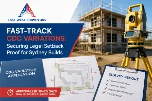
- Subdivision Surveys – Prepares legal plans to divide land (e.g. Torrens Title)
- Legal Documentation – Prepares reports required by councils or for legal disputes
- Collaboration – Works closely with architects, builders, and certifiers
Basically, they’re the go-to people when it comes to land. Without them, things would get very messy, very fast!
How Surveying Started in Australia
Story time! Surveying has been a big deal in Australia since the very beginning.
Back in the late 1700s, when the first British colonies showed up, they needed someone to figure out how to divide the land. So, the earliest surveyors came along with maps, tools, and a lot of guesswork.
Fast forward to today, and land surveyors are still doing the same job. Just with way better tech. Think laser scanners, GPS, and even drones. We’ve come a long way from walking around with a rope and a compass.
Types of Land Surveys
Not all land surveys are the same. Here are the main types, and why you might need one.
1. Boundary Identification Survey
Why you need it: To know exactly where your legal property boundary lies.
Useful for: Buying, fencing, or resolving disputes.
2. Detail & Contour Survey
Why you need it: To show the features, levels, and layout of your land.
Useful for: Building approvals, site planning, and architectural design.
3. Set-Out Surveys
Why you need it: To accurately mark out buildings, walls, slabs or pools on-site.
Useful for: New homes, renovations, extensions, or civil works.
4. Torrens Title Subdivision
Why you need it: To divide your land into separate titles.
Useful for: Property development, duplexes, or selling land parcels.
5. Work As Executed (WAE) Survey
Why you need it: To confirm construction was completed as per approved plans.
Useful for: Council sign-off, project handovers, drainage or driveway certifications.
How a Survey Actually Happens
So what’s the deal? How do these surveys actually get done?
Here’s the basic process (and yes, it’s more than just walking around with a clipboard).
1. Research
Check existing plans, title boundaries, and council info.
2. Field Work
Visit the site and collect data using GPS or total stations.
3. Calculations
Process all the data with specialised surveying software.
4. Plan & Report
Deliver a final plan for your builder, architect, or certifier.
Modern Tech Surveyors Use Today
Surveying used to be a real pain. Think chains, chalk, and sore legs. These days, it’s way cooler.
Here’s some of the gear they use now,
- GPS & GNSS: Super-accurate satellite tools that pinpoint locations within millimetres.
- Drones: Yep, flying robots. They take photos and 3D scans of land from above.
- 3D Laser Scanners: These shoot lasers (yes, lasers!) to create full 3D models of the land.
- Survey Software (CAD/GIS): Helps surveyors layer maps, zoning info, and more to give a full picture.
All this means better accuracy, less guesswork, and way cooler reports.
When Do You Even Need a Survey?
Okay, here’s the big question: Do I need a survey?
If you’re doing any of these things, the answer is probably yes.
- Buying property: Make sure what you’re buying is actually what’s on the title.
- Selling land: Give buyers clear info. No surprises = faster sale.
- Building or renovating: You can’t just guess where your house should go.
- Splitting land: Councils won’t approve a subdivision without a proper plan.
- Finalising construction: Confirms drainage and build completion
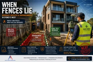
- Sorting disputes: Your neighbour swears their shed’s on their side. A survey proves who’s right.
- Dealing with councils: A legal survey plan is often mandatory for permits.
Basically, if it involves land, and money, and people – get a survey.
How to Pick a Good Surveyor
How do you know you’re picking the right person for the job?
- Registered: Only registered surveyors can do legal boundary work. Check your state’s surveying board.
- Experienced: Choose someone who’s done jobs like yours before.
- Uses modern gear: Laser scanners, GPS. You want someone up to date.
- Good communicator: You don’t want confusing reports or vague answers.
- Transparent pricing: Get a clear quote with no surprises later.
A good surveyor can save you time, stress, and money. A bad one? Total nightmare.
The Legal Side of Surveying Stuff
Surveying is serious business. It’s not just about measurements. It’s about legal boundaries. That’s why surveyors have to be properly licensed.
- In Australia, only registered land surveyors can do official boundary surveys.
- Their reports are legal documents. You can take them to court or use them for property sales.
- Councils and the Land Titles Office use survey plans to register land officially.
- Subdivisions need properly prepared surveys before anything gets approved.
So yeah, it’s not just about drawing pretty maps. Surveying can have major legal consequences if done wrong.
Stuff People Get Wrong About Surveying
Let’s bust a few common myths.
- “The fence shows where my property line is.”
Nope. Fences are often built way inside the boundary. Or sometimes way over it.
- “Only developers need surveys.”
Regular homeowners need them too. Especially if you’re building or selling.
- “My builder will figure it out.”
Builders rely on surveyors to tell them where to build. Don’t skip that step.
- “It’s too expensive.”
It’s actually way cheaper than fixing a legal mess down the track.
Wrap Up
If there’s one thing to remember from all this, it’s this,
Land surveying is a small step that saves you from big headaches.
Doesn’t matter if you’re planning a big project, buying a block of land, or just trying to keep things legal and tidy. A professional land survey can make all the difference. It clears up confusion, gives you peace of mind, and helps you move forward with confidence.
Need a Land Survey?
At East West Surveyors we make the surveying process simple, stress-free, and accurate. Whether it’s a boundary survey or a full subdivision, our team’s got you covered.
Request a free quote today and let’s get your project on the right track.