Introduction: The Illusion of the Fence Line
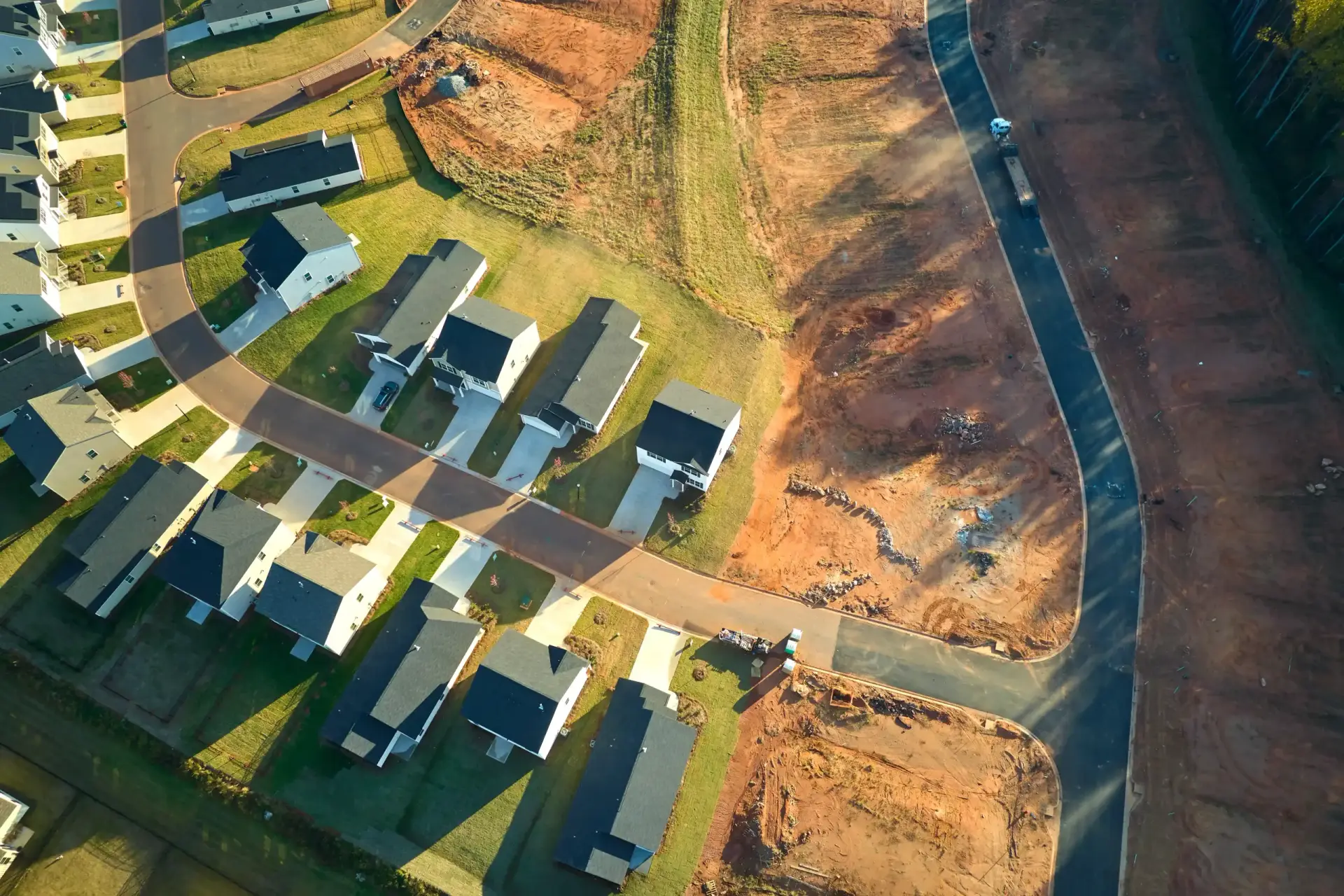
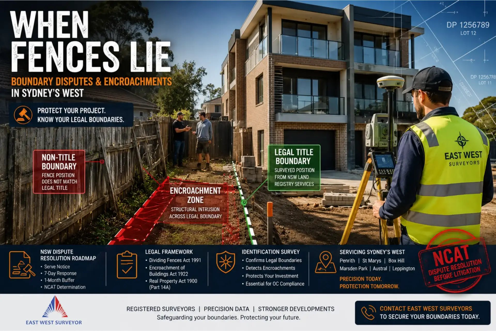
In mature redevelopment hubs like Penrith and St Marys, relying on a physical fence line is a recipe for a Supreme Court injunction. These decades-old structures are frequently "Non-Title Boundaries" that fail to align with the cadastral boundaries held by NSW Land Registry Services. For a developer, assuming a fence reflects the legal title is a high-stakes gamble that often ends in litigation.
Modern 3-storey townhouse and duplex projects operate with razor-thin setbacks and strict compliance margins. A discrepancy of just 10cm can transform a profitable build into a massive liability, potentially requiring the demolition of fire-rated walls. In the current Western Sydney market, what starts as a neighbourly disagreement over a fence can quickly escalate into a serious and costly affair.
Section 1: The Legal Threshold – Fences vs. Encroachments
Strategic risk mitigation begins with identifying whether your dispute falls under shared maintenance or structural intrusion. The legal remedies and costs for these two categories differ significantly under NSW law.
- Dividing Fences Act 1991: Governs the shared costs, height, and materials for fencing work that separates neighbouring properties.
- Encroachment of Buildings Act 1922: Applies when a permanent structural element, such as a townhouse wall, foundation, or balcony, intrudes across a legal boundary.
- Encroachment: This is any structural intrusion across a legal line, which can trigger claims for compensation or removal.
Developers must remain hyper-vigilant regarding "Airspace Encroachment," particularly with eaves and gutters on 3-storey builds. Under the Encroachment of Buildings Act 1922, even an overhanging balcony is considered a structural intrusion. This can lead to a refusal of the Occupation Certificate (OC) if not resolved via an easement or building realignment.
Section 2: The Escalation Pathway – A Legal Timeline
If a boundary is in doubt, following the "NSW Boundary and Fencing Dispute Resolution Roadmap" is essential to protect your project. This timeline creates a formal paper trail that is mandatory before seeking orders from NCAT.
Phase 1: The Notice Serve a formal Boundary Notice to state your intent to define the line, or a Fencing Notice for shared work. For any dividing fence dispute, you must serve this notice at least one month before you can lodge an application with NCAT.
Phase 2: The 7-Day Window Upon receiving a Boundary Notice, a neighbour has a strict 7-day window to respond in writing. They must either mark the line with survey pegs or hire their own registered surveyor to verify the position.
Phase 3: The 1-Month Buffer If the neighbour fails to act, you must wait for a one-month buffer period before hiring your own registered surveyor to define the line for all purposes. This same one-month period must pass after a Fencing Notice before NCAT will hear an application.
Phase 4: The Determination Under Part 14A of the Real Property Act 1900, you can file Form 14TB: Determination of title boundary with the Registrar General. This is a quick and inexpensive alternative to the Supreme Court, costing $175.70 (as of July 2025). The Registrar General provides a 21-day window for submissions, and any dissatisfied party has 28 days to appeal the decision to the Land and Environment Court.
Section 3: The Solution – The Identification Survey as Your Ultimate Defence
The Identification Survey is the primary tool to reconcile physical occupation with legal title, especially for properties with Limited Torrens titles. It legally identifies the true boundary and any "improvements" on the lot, effectively neutralising claims of "possessory rights." This report acts as your definitive cadastral evidence if a dispute reaches NCAT.
In greenfield estates like Box Hill and Marsden Park, newly pegged subdivisions can shift during civil works and bulk earthworks. An Identification Survey ensures your footings are placed correctly relative to the Section 88B instruments and design covenants governing the estate. This proactive step prevents the nightmare scenario of discovering an encroachment after the slab is poured.
This survey also detects "Zone of Influence" risks near Sydney Water mains or old council stormwater Easements in Penrith. By locating these legal rights of access early, you ensure that 3-storey foundations do not compromise critical infrastructure. Failing to respect these easements can lead to mandatory demolition orders from the local council.
Section 4: The Multilevel Risk – Why 3 Storeys Change the Equation
Building to three storeys amplifies the consequences of a boundary error exponentially due to the structural weight and fire-safety requirements. Once misplaced columns or fire-rated walls are cast in concrete, they cannot be shifted without catastrophic financial loss. Waiting until an NCAT dispute arises during the framing stage is usually too late to save the project’s margin.
In the high-growth corridors of Austral and Leppington, terrain variations and flood-plains introduce additional layers of risk. Developers must integrate boundary data with Flood Level Surveys to ensure strict adherence to Minimum Floor Levels. These developments often involve complex Section 88B instruments and Positive Covenants that mandate specific site drainage solutions.
Furthermore, councils in Austral and Leppington often require Work As Executed (WAE) surveys for on-site stormwater detention (OSD) systems. These surveys confirm that the final infrastructure matches the approved plans before an Occupation Certificate is granted. Proactive surveying is the only way to navigate these intersecting legal and engineering requirements safely.
Conclusion: Secure Your Line with East West Surveyors
Boundary disputes are "serious and costly affairs" that frustrate the proper use of land and delay critical housing supply. For builders in Box Hill, Leppington, and Penrith, the stakes are simply too high to rely on a decades-old fence. A small investment in a registered surveyor today prevents a multi-year battle in the Land and Environment Court.
Do not risk your Occupation Certificate or your reputation on a "Non-Title Boundary." Secure a Final Identification Survey before you pour your slabs to confirm the structure is within correct legal limits. Contact East West Surveyors today to safeguard your development from litigation and ensure your project is built on solid, legal ground.